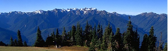
Deer Park
 Deer Park, elevation 5233, is situated on Blue Mountain, elevation
6007. The views from Deer Park include Port Angeles, the Strait of Juan
de Fuca, Vancouver Island, The Olympic Mountains, and Mt. Baker. Deer
Park is also the starting point for many back country hikes, and one of
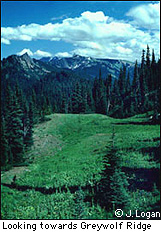
the most popular is the Obstruction Point Trail, which connects Deer
Park to Hurricane Ridge. Enjoy spectacular views, and great photo
opportunities.
Deer Park, elevation 5233, is situated on Blue Mountain, elevation
6007. The views from Deer Park include Port Angeles, the Strait of Juan
de Fuca, Vancouver Island, The Olympic Mountains, and Mt. Baker. Deer
Park is also the starting point for many back country hikes, and one of
the most popular is the Obstruction Point Trail, which connects Deer
Park to Hurricane Ridge. Enjoy spectacular views, and great photo
opportunities.
Directions:
Drive
east of Port Angeles to mile post 253 or Deer Park road. The first 8
miles are paved, then the way becomes progressively steeper and
narrower. Continue on Deer Park Road, at 16 miles you will reach the
Deer Park ranger station and Obstruction Point Trail head. Road not
recommended for RV's.
Travel Time:
40 to 60 minutes
Mileage Distance:
19 miles
Best Time of Year:
Late Spring, Summer, Early Fall
Special Notes:
Overnight camping sites, No RV's, No pets, Closed in Winter
|