Lake Crescent - Rating:
Easy
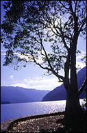
 This
spectacular
crescent shaped mountain lake is found just inside the borders of Olympic National
Park. Lake Crescent is a deep water lake and is always a deep blue color.
There are waterfalls to explore, trails to walk and restaurants with views
of the lake. The lake is known for crystal clear water with visibility up
to 100 ft. There are very few powerboats that use the lake and jet skis
are not permitted. The wind can come up, especially from the west, in the
afternoon and the area around the Log Cabin Resort is often the least
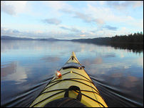
affected. The area offers some wonderful flat water lake kayaking and
there are several points to launch from and over 30 miles of shoreline to
explore.
Possible locations for your kayak launch:
- Barnes Point, found at the Storm King Ranger Station
- East Beach - from along Highway
101 take East Beach Road, then before you reach Lake
Crescent look for signs to the beach.
- Fairholm, found at the west end of Lake Crescent along Highway 101.
- Log Cabin Resort has a public boat launch and is the best location for kayaking to Devil's
Punch Bowl. Take East Beach Road, then take Piedmont Road.
Also view: Lake
Crescent, Olympic National Park
Directions: Follow Highway 101 West of Port Angeles for a
beautiful 17 miles, look
for signs to either Piedmont Road, or continue on 101 till you reach the
shores of the lake.
Lake Mills - Rating:
Easy
Lake Mills is formed by the Glines Cayon dam, and is found inside of
Olympic National Park. (A park entrance fee is collected.) This lake is 1
mile long and is a deep green color from glacier slit. Great lake to kayak
on and see the Olympic Mountains with great views of snowcapped Mt. Fitz
Henry. Caution: The wind can come up in the
afternoon, making for a difficult return trip.
Directions: Follow Highway 101 West of Port Angeles, follow
signs to the entrance of Olympic National Park and the Elwha Valley. After
entering the park, follow the road until you reach the lake. Boat launch
can be found on right of lake. This is a great lake to kayak when you
kayak Lake Aldwell since they are only 10 miles apart.
Lake Ozette
 This
lake is the largest lake on the Olympic Peninsula and the third largest in
Washington State. Camping, fishing and hiking possibilities are found here.
A deep natural lake with many beaches, one designated camp location, and
two islands for exploring and camping possibilities. Hiking is also
possible to Sand Point for Erickison's Bay.
Also view: Marine
Camping on Lake Ozette
Directions: Follow Highway 101 West of Port Angeles. Then
follow Highway 112 to Clallam Bay, pass through Clallam Bay and follow
highway 112 until you see signs for Ozette Wilderness. Take a left on
Hoko-Ozette Road follow to end. There are two possible launching
locations. Swan Bay, which can be found on Swan Bay Road, this is best if
you plan to go to Garden Island (2 miles before end of road). If you
follow Hoko-Ozette Road to the end you will see the Olympic National Park
boat launch at the top end of the lake.
Lake Pleasant
This mile long natural lake is a great kayak on a sunny day.
There are many homes found along the shore of this lake, and a logging
yard. Easy access for launching and play area for kids and picnic tables.
Also view: Lake
Pleasant, Clallam County Park
Directions: Follow Highway 101 West past Lake Crescent,
look for signs for Lake Pleasant near the community of Beaver.
Hollywood Beach -
Rating: Easy
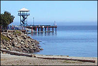
 Found
in downtown Port Angeles at the Port Angeles City Pier. Launch you kayak
here in the protected water of the Port Angeles Harbor and explore the
Port Angeles water front and harbor.
Also view: Waterfront
Trail, Port
Angeles Tides
Directions:
Follow either Lincoln, Front or First Streets to the Port Angeles water
front.
Ediz Hook - Rating: Easy
 There
are two parks found on the this natural sand spit, which give Port Angeles
a protected harbor. Harborview and Sail and Paddle parks both offer picnic
areas and have boat launches. Paddling around in the harbor is
fascinating. The views are stunning of the town, with the towering Olympic
Mountains behind it. But the up close and personal view of the log storage
areas, ships at anchor, pilot boat activity, Coast Guard helicopters, and
salmon fish pens will keep you entertained and busy looking. Also look for
harbor seals, sea lions and bald eagles. A fun thing to do is paddle from
the “hook” to Hollywood Beach by the City Pier. Here you can stop and
rest and have a snack at a waterfront café or restaurant. You can proceed
further east along the waterfront or head back to the “hook” whenever
you have had enough.
Also view: Port
Angeles Tides
Directions: Follow Front Street, which will turn into
Marine Drive after you pass the Port Angeles Boat Haven. Follow Marine
Drive through the Nippon Paper mill and on to Ediz Hook. The road ends at
the Coast Guard Station. Along the way are several areas to park and
launch your kayak.
Tongue Point/Salt Creek
- Rating: moderate to
advanced
Great coves and tides pools can be found here. Check tide
tables for best times. Can be made into a day trip by kayaking 9 miles to
Freshwater Bay and back. These waters can be both calm and very rough, so
check weather and tides before heading out.
Also view: Salt
Creek Recreation Area, Clallam County Parks
Tides: Crescent
Bay Tides
Directions: Follow Highway 101 West of Port Angeles, then
take Highway 112 and head west. Look for signs for the Salt Creek
Recreation Area found on Camp Hayden Road. Stay left and go past the main
entrance and you will find a parking area on right. You will need to carry
your boat 100-200, yards depending on tides.
Freshwater Bay
- Rating: moderate to
advanced
A semi protected bay found 10 miles west of Port Angeles that
offers an ideal area to start your paddle. This section of rugged
coastline offers more wind and wave action than some of the other trips
mentioned but vistas, wildlife and sea life make the little more work
worth the effort. Be aware of your abilities and don’t over extend
yourself. The tides and wave action can sometimes make it more difficult
to get back. Can
kayak to Tongue Point/Salt Creek to make a great day trip. Lots of great
coves and beaches to explore and land at. These waters can be both calm and
very rough, so check weather and tides before heading out.
Also view: Freshwater
Bay, Clallam County Park
Tides: Crescent Bay Tides
Directions: Proceed west on Highway 101 from Port Angeles
to State Rt. 112. Take Rt. 112 to Freshwater Bay Road, turn right and you
will end up at a Clallam County boat launch.
Dungeness Bay - Rating: moderate
Launch here to explore Dungeness Bay, and possibly a trip to
the Dungeness Lighthouse. The Dungeness Spit provides protection to this
part of the Strait of Juan de Fuca and Dungeness Bay but pay attention to
the weather and winds. The Wildlife Refuge is a national bird sanctuary so
watch for the hundreds of species that come to area along with the eagles,
seals, sea lions and abundant sea life. Watch for Sea
Otters, which will follow you in the bay. Can be very windy, so check
weather report and tide tables. The Dungeness Spit is off-limits to water
access except at the designated area by the Lighthouse with reservations
(360-457-8451). You can paddle out to the Dungeness Lighthouse but
remember to make reservations. From this vantage point you can see Mt.
Baker, west to Port Angeles and south to the Olympic Mountains.
Also view: Cline
Spit County Park Dungeness
Recreation Area
Tides: Dungeness
Bay Tides
Directions: From Port Angeles head 12 miles east on Highway
101 to the Dungeness National Wildlife Refuge. Left turn on Old Olympic
Highway at O'Brien Road. Follow Old Olympic Highway, approx
6 miles. It will make a sharp turn left and changes into Cays road. Follow
Cays road until it turns into Marine Drive which follows along the water.
Look for the sign to Cline Spit. Hiking access to the Wildlife Refuge is
through the Voice of America / Dungeness State Park. Take Highway 101 to
the Left turn on Old Olympic Highway at O'Brien Road then turn left on
Kitchen-Dick Road. Proceed to the end of Kitchen-Dick and it turns into
Lotzgesell and the main entrance of the refuge.
Take 101 west to State Rt. 110 west and you will find yourself in the Quileute Indian Reservation and the town of La Push. Here during the winter months and into spring the waves are big and the rivers run fast, which means great conditions for the latest use of kayaks; surf kayaking, and white water river kayaking. The beaches of Rialto, First, and Second are some of the favorite spots with winter waves reaching 20 feet. Due to the high waters debris can often be dragged into the surf, so be aware and note that conditions here change quickly and should only be challenged by the most advanced paddlers.
The headwaters of the Sol Duc River start high in the Olympic
Mountains, and winter through early summer the rapidly flowing water
offers some terrific kayak opportunities for the expert rider. Local
riders have favorite spots where the river forms continually cresting
waves giving the rider great opportunities for surfing. Again this form of
kayaking is only for the advanced and helmets, and dry or wet suits are
recommended.
Tides: La Push, Quillayute
River Tides
| For More Information | |
| Olympic Raft and Kayak | |
| Address: | 123 Lake Aldwell Road Port Angeles, WA 98363 |
| Phone: | (360) 452-1443 |
| Toll Free: | 1-888-452-1443 |
| Web Site: | www.raftandkayak.com |
| Adventures Through Kayaking Outfitters | |
| Address: | 4821 S. Dry Creek Rd Port Angeles, WA 98363 |
| Phone: | (360) 417-3015 |
| Toll Free: | 1-888-900-3015 |
| Web Site: | www.atkayaking.com |
| Sound Bikes and Kayaks | |
| Phone: | (360) 457-1240 |
| Web Site: | www.soundbikeskayaks.com |